


View Canadian weather radar, satellite imagery, GFA, and surface analysis charts.
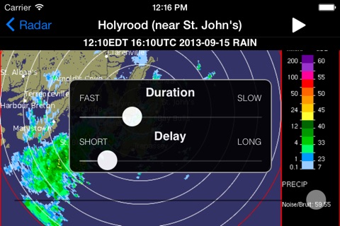
--- Radar Map ----
View up to 3 hours of radar animations for all of North America (including Alaska & Hawaii) and choose between Precipitation Rate imagery calibrated for either rain or snow. Customize animation speed, delay, radar opacity, and map type.
--- Radar Images ---
Canada Weather is location-aware and can automatically find the closest radar station. Select from a list of 31 stations nationwide, including five regional views: Pacific, Prairies, Ontario, Quebec, and Atlantic. Animate up to 100 images calibrated for either rain or snow and displayed in one of two preset formats. Visit the Environment Canada website for a detailed map of radar coverage in your area.
--- Satellite ---
View satellite imagery from the GOES-16 weather satellite in visible light, infrared, and combined. Choose between the Meteorological Society of Canada (MSC) or the US National Oceanic and Atmospheric Administration (NOAA) and animate up to 6 hours of imagery. Coverage includes all of Canada and most of the USA.
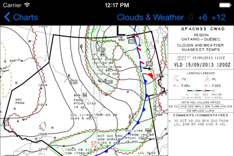
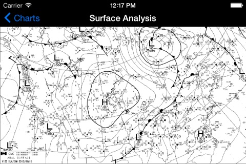
--- Charts ---
View Surface Analysis and Graphical Area Forecast (GFA) charts for all of Canada. The Surface Analysis is a snapshot of the current pressure and frontal systems across Canada. GFAs give you a 12-hour forecast of the expected pressure and frontal systems at a regional level, along with information such as expected precipitation, cloud height & coverage, turbulence, icing, and freezing level. While these charts are typically used by pilots, they offer an excellent look at the current weather systems in a given region.
Quickly switch between 0/+6/+12 GFA images and between "Clouds & Weather" and "Icing, Turbulence, & Freezing Level" images. You can also view GFA pairs side-by-side instead of having to switch between them.
--- Data Providers ---
Radar: Environment Canada
Satellite: Meteorological Service of Canada (MSC), National Oceanic and Atmospheric Administration (NOAA), Cooperative Institute for Research in the Atmosphere (CIRA)
Charts: NAV CANADA